The
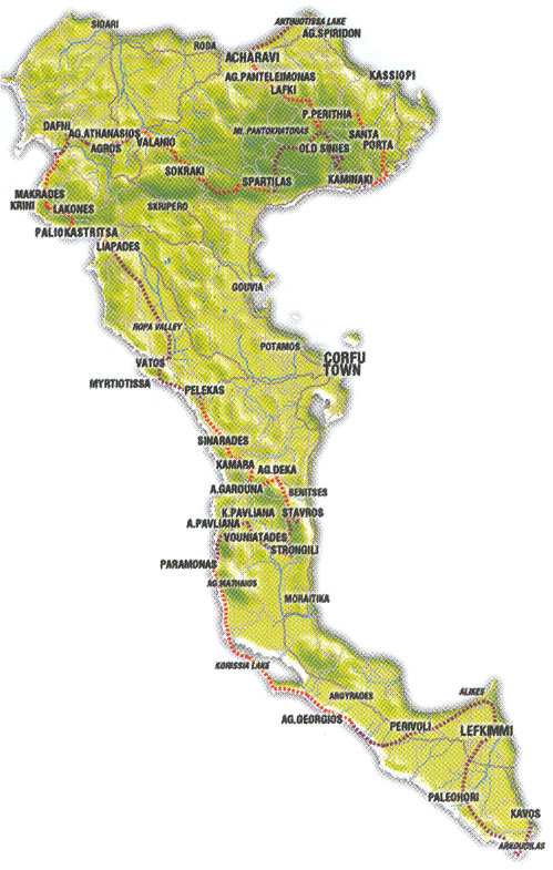
Corfu trail is a long-distance footpath of approximately 220 km, which runs the length of Corfu island: from the white cliffs near Arkoudillas at
Corfu's southernmost tip to Cape Agia Ekaterini at its northernmost point. The trail meanders through all the island’s rural districts and avoids developed areas, takes in beauty spots, biotopes, beaches, picturesque
villages, monuments, monasteries and diverse landscapes. The original paths have been cleared and way-marked with CT yellow sings, without disturbing the environment, and placed in strategic locations on the route. With the help of the accurate
Corfu trail map – and guide book you will easily be able follow the trail. Since the most spectacular scenery and the biggest concentration of highlights are n the north of the island, walkers are advised to follow the route from south to north, through the
Corfu trail has been waymarked in bth directions.
The
Corfu trail consists of 11 (including 2 minor) daily walks combining continuously the most beautiful seashores and landscapes. And the terrain varies, with rough footpaths, cobbled mule paths, dirt and gravel tracks and some minor roads and sandy and pebbly Corfu beaches. The best months to follow this unique trail are from February to June and from September to November.